 2026-01-02
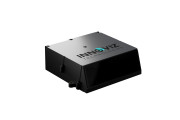
Innoviz Technologies Ltd. (the "Company" or "Innoviz"), a leading Tier-1 direct supplier of high-performance, automotive-grade LiDAR sensor platforms and complementary software stacks, launched today the Company's latest development: the InnovizThree LiDAR. InnovizThree was designed with slimmer dimensions and lower power consumption, all while delivering exceptionally high-performance at a dramatically reduced price compared to InnovizTwo. The newly slimmed-down design allows InnovizThree to be seamlessly integrated behind the windshield or on...
Continue reading →
 2025-12-03
Innoviz Technologies Ltd., a leading Tier-1 direct supplier of high-performance, automotive-grade LiDAR sensor platforms and complementary software stack, announced today that Daimler Truck, one of the world's leading commercial vehicle manufacturers and Torc Robotics, a subsidiary of Daimler Truck, have selected Innoviz as its Short-Range LiDAR supplier for series production SAE Level 4 autonomous Class 8 semi-trucks. This announcement follows Innoviz's previous disclosure that a major commercial vehicle OEM had selected the Company for future se...
Continue reading →
 2025-11-24
CHASING INNOVATION TECH CO., LTD., a global leader and innovator in underwater robotics, today introduced the CHASING L1 Ultra — a first-of-its-kind pool-cleaning system designed to redefine pool maintenance through the integration of 360° LiDAR mapping and AI Vision. More than a cleaner, the L1 Ultra represents the pinnacle of CHASING’s innovation — a fully autonomous, AI-powered system that sees, thinks, and acts with precision, transforming pool care into an effortless experience of perfection. ...
Continue reading →
 2025-11-07
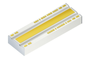
Autonomous driving demands sensor technology that delivers precision, reliability, and long-range performance every second. LiDAR systems capture the environment in three dimensions, regardless of lighting conditions, and enable safe, real-time decision-making. With its new 5-junction edge-emitting laser, ams OSRAM introduces a key component that elevates these systems to a new level of performance. Compared to the previous 3-junction technology, the new laser offers significantly higher optical peak power while consuming less electrical current. The 3-junction laser alrea...
Continue reading →
2025-06-19
Innoviz Technologies Ltd., a leading Tier-1 direct supplier of high-performance, automotive-grade LiDAR sensors and perception software, announced today a partnership with Cogniteam Ltd., the AIoT and robotics cloud platform. The collaboration combines Innoviz's cutting-edge InnovizSMART Long-Range LiDAR with Cogniteam's robust analytics and management platform to offer an innovative, turnkey observation solution for a wide range of safety and security applications.
Continue reading →
 2025-06-04
Aeva®, a leader in next-generation sensing and perception systems, today announced that Swiss Urban autonomy software provider
Loxo has selected its long-range 4D LiDAR technology for integration into Loxo’s autonomous driving platform, Digital Driver. The partnership begins with the deployment of Aeva Atlas™, Aeva’s state-of-the-art 4D LiDAR sensor, across Loxo’s delivery vehicle fleet.
Aeva Atlas will be used on Loxo delivery vehicles, designed for middle and last-mile logistics. Loxo selected Aeva for its breakthrough sensing...
Continue reading →
2025-05-21
Aeva®, a leader in next-generation sensing and perception systems, today announced that it has been selected by Airbus UpNext, a wholly-owned Airbus subsidiary created to explore innovative technologies, to supply its cutting-edge 4D LiDAR technology for the Optimate smart automation demonstrator. Aeva’s unique 4D LiDAR technology uses Frequency Modulated Continuous Wave (FMCW) sensing to simultaneously detect precise distance and velocity for each point in a scene — a major advancement over traditional LiDAR systems. Its ability to deliver hi...
Continue reading →
 2025-05-16
Innoviz Technologies Ltd., a leading Tier-1 direct supplier of high-performance, automotive grade LiDAR sensors and perception software, today announced an expansion of its collaboration with Volkswagen Autonomous Mobility to accelerate the integration of InnovizTwo LiDAR units into the ID. Buzz AD, VW's L4 autonomous shuttle. The expansion is expected to accelerate the integration of InnovizTwo LiDAR units into the ID. Buzz AD autonomous shuttle platform, supporting MOIA's planned market expansion in multiple European and U.S. cities begin...
Continue reading →
 2025-04-02
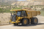
Luminar, a leading global automotive technology company, announced a collaboration with Caterpillar Inc. to integrate LiDAR technology into Caterpillar’s next generation autonomous solution.
LiDAR, which stands for Light Detection and Ranging, is critical for navigation and obstacle detection in autonomous machines. LiDAR uses light in the form of a pulsed laser to continuously scan the surrounding environment and provide high-precision measurement of the shape and size of objects nearby.
The Luminar LiDAR technology will be introduced with Cat® C...
Continue reading →
2025-03-10
Luminar, a leading global automotive technology company announced that Luminar’s technology will be equipped in the new Volvo ES90, which is slated for production this year. This marks the second Volvo car model to feature Luminar’s technology, following the successful launch of the automaker’s flagship SUV, the Volvo EX90, which is now being delivered to customers.
“We’re proud to be selected in conjunction with industry leaders like NVIDIA for a second global automotive launch as Volvo Cars expands its new lineup,” said Austin ...
Continue reading →
 2025-01-22
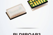
ROHM has developed a high output laser diode - RLD8BQAB3 - for use in ADAS (Advanced Driver Assistance Systems) equipped with LiDAR for distance measurement and spatial recognition. ROHM will initially start supplying samples targeting consumer and industrial applications such as drones, robot vacuum cleaners, AGVs (Automated Guided Vehicles), and service robots. LiDAR is seeing growing adoption in recent years across a variety of applications that require automation such as automotive ADAS, AGVs, drones, and robot vacuums, facilitating preci...
Continue reading →
 2025-01-21
TrendForce’s latest report, “2025 Infrared Sensing Application Market and Branding Strategies,” reveals that LiDAR is gaining traction in automotive markets—including passenger vehicles and robo-taxis—as well as in industrial applications such as robotics, factory automation, and logistics. Propelled by advancements in Level 3 and higher autonomous driving systems and logistics solutions, the global LiDAR market is forecast to grow from US$1.181 billion in 2024 to $5.352 billion in 2029, achieving a robust CAGR of 35%.
Under increasin...
Continue reading →
2025-01-14
Innoviz Technologies Ltd. (Nasdaq: INVZ) (the "Company" or "Innoviz"), a leading Tier-1 supplier of high-performance, automotive-grade LiDAR sensors and perception software, is proud to announce its latest technological advancements, which will be showcased at CES 2025. Highlighting the power of its perception software, Innoviz will demonstrate how it runs seamlessly with the NVIDIA DRIVE AGX Orin platform, offering a range of software-driven features designed to accelerate autonomous driving applications.
Continue reading →
 2024-12-30
LiDAR solution specialist Vueron Technology (hereafter “Vueron”) is set to participate in CES 2025, which will be held in Las Vegas, USA, from January 7 to January 10. Building on its existing portfolio of LiDAR-based autonomous driving and smart infrastructure solutions, Vueron is ready to showcase yet another groundbreaking innovation at the event. At CES, Vueron will debut its zero-cost LiDAR solution, VueX, for the first time. VueX is an innovative platform that leverages Vueron’s core strength—its robust LiDAR percep...
Continue reading →
 2024-12-19
Innoviz Technologies Ltd., a leading Tier-1 supplier of high-performance, automotive grade LiDAR sensors and perception software, today announced its participation in the Consumer Electronics Show (CES) 2025, taking place January 7th – 10th in Las Vegas, Nevada. Visitors can experience the latest in LiDAR technology at the Innoviz booth, located at LVCC, West Hall booth #4216. The Company will present live demonstrations of its latest LiDAR technology including both short and long-range LiDARs, offer a chance to meet with management, and showcase...
Continue reading →
 2024-12-19
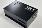
SiLC Technologies, Inc. (SiLC), the leading developer of integrated single-chip FMCW LiDAR solutions, today announced the launch of Eyeonic® Trace, its revolutionary Class 1 Laser Line Scanner capable of dimensioning objects with extreme accuracy, even from distances up to 10 meters. Targeted to industrial automation applications, the new Eyeonic Trace is an all-in-one inspection and measurement tool for objects moving on conveyor belts, bucket elevators and assembly lines or being scanned by a robotic arm.
The market for industrial and robotics solutions ...
Continue reading →
2024-11-20
MADRID - Nov. 12, 2024 - Ommatidia LiDAR, an innovator in advanced 3D optical metrology and LiDAR systems, announced that it will officially simultaneously launch its Q2 Laser RADAR at two major industry events this year: SPS 2024 in Nuremberg, Germany (November 12-14), and Precisiebeurs 2024 in s’Hertogenbosch, Netherlands (November 20-21).
The Q2 Laser RADAR represents a significant leap forward in the industry, blending high-precision 3D dimensional metrology with advanced vibration analysis, all in one powerful tool. This new system is...
Continue reading →
 2024-11-05
While LiDAR is a powerful technology with unique capabilities, it's not without drawbacks. Its effectiveness often depends on the specific application and context.
So, we might have written about LiDAR once in a while. Well, maybe a wee bit more than that.
And why not? LiDAR excels in providing highly accurate and detailed 3D mapping capabilities, making it invaluable across every industry. Its ability to quickly collect data from challenging environments, coupled with minimal human intervention, enhances efficiency and reduces costs.
It even was instrumen...
Continue reading →
 2024-11-01
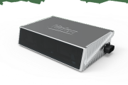
What is a Long-range LiDAR Sensor ?
Building on over 14 years of automotive-grade LiDAR experience, Valeo’s SCALA™ Gen 3 Long Range LiDAR Sensor is at the forefront of advanced driving technology. With its outstanding performance, the Valeo’s SCALA™ Gen 3 is enhancing both safety and comfort; being a key enabler for level 3-4 highway and urban autonomous driving, but also extanding the Operationnal Domain Design of L2+ ADAS functions. This technology is based on our leadership in releasing automotive-grade LiDARs, inc...
Continue reading →
 2024-10-29
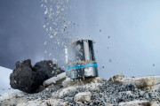
St Albans-based sensor specialist SICK has expanded its high-performance multiScan and picoScan LiDAR ranges to make them even more powerful, compact and robust. With a variety of industry specific software applications that run on-device, SICK is taking LiDAR sensor technology to new levels of performance, reliability and flexibility.
The modular multiScan 100 3-D product family and compact picoScan 150 LiDAR sensors are customisable to suit a wide range of applications, with bespoke parameters, operation and integration. From robotic guidance and outdoor...
Continue reading →
 2024-09-13
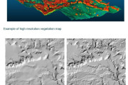
Hawke’s Bay Regional Council (HBRC), in collaboration with researchers from Manaaki Whenua, have completed a pioneering project using LiDAR (Light Detection and Ranging) technology to gain a deeper understanding of the region's landscape.
This project uses LiDAR to create high-resolution maps detailing land and vegetation across the region, providing an unprecedented level of detail on the region’s topography.
The newly developed digital elevation models (DEMs) enhance the accuracy of assessments for erosion, sediment loads in rivers, and overa...
Continue reading →
 2026-01-02
 2025-12-03
 2025-11-24
 2025-11-07
 2025-06-04
 2025-05-16
 2025-04-02
 2025-01-22
 2025-01-21
 2024-12-30
 2024-12-19
 2024-12-19
 2024-11-05
 2024-11-01
 2024-10-29
 2024-09-13