Velodyne Lidar announced Kaarta has included Velodyne’s smart, powerful lidar technology in Kaarta’s new Stencil 2-32 ground surface mapping solution. Equipped with Velodyne LiDAR, Stencil 2-32 scans ground level surfaces, mapping items such as curbs, manholes, signs, poles, and other features at a fraction of the cost of traditional mobile mapping systems. The Stencil platform helps enable city planning for infrastructure improvements as well as parking and traffic management.
The 3D data generated by Stencil 2-32 can be utilized for a range of applications including BIM modeling, geospatial data analytics, and cataloging tools. For example, Allvision uses Stencil 2-32 along with data from an autonomous vehicle developer to conduct curb occupancy analysis in Pittsburgh’s Strip District, an area known for high on-street parking demands. Called Allvision Parkview, the solution allows city planners to monitor parking behavior to improve transportation planning and curb management.
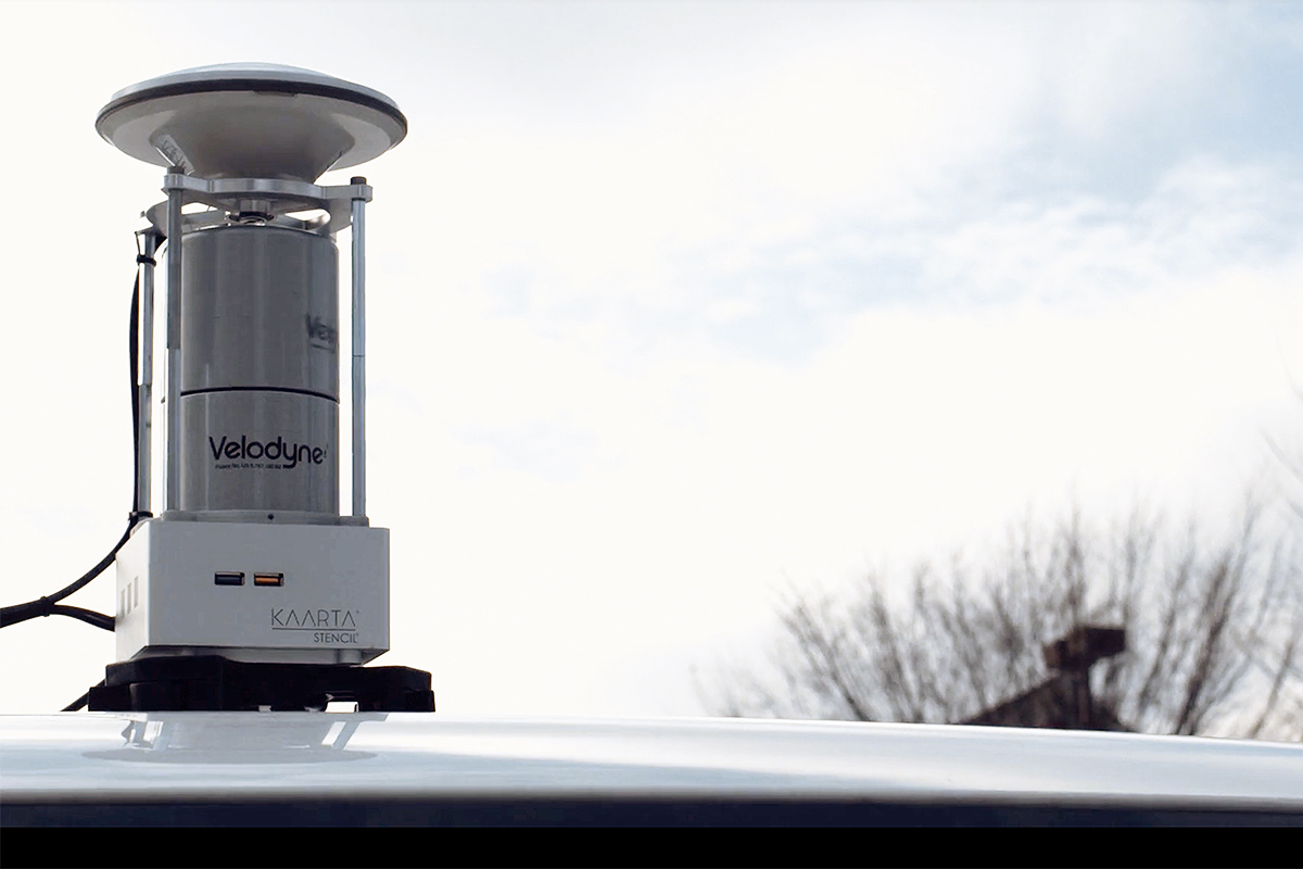
(Image: Velodyne Lidar/Kaarta)
“The addition of Stencil 2-32 to Kaarta’s product line further extends the range of mapping applications for mobile LiDAR scanning,” said Kevin Dowling, Ph.D., CEO, Kaarta. “The low noise, long range, and field of view of Velodyne’s compact LiDAR sensors allow us to create systems with immense versatility, accuracy, and speed – from capture to answer.”
Stencil integrates 3D mapping and real-time position estimation to create capabilities not possible with fixed-base scanning systems. Stencil 2-32 incorporates the Velodyne HDL-32E LiDAR sensor, which provides a range of 100 meters and a data rate of 720,000 points per second. Kaarta leverages advanced robotics technology that combines input from multiple sensors – LiDAR, visual odometry, and inertial measurement unit (IMU) – and processes that data in real time. For some applications, the data can be enhanced with Global Navigation Satellite System (GNSS) positioning and wheel odometry sensors.
“Velodyne lidar and Kaarta’s advanced 3D mapping and localization algorithms are a phenomenal combination, creating a portable system for fast and easy detailed surface mapping,” said Aaron Morris, Founder and CEO, Allvision. “The ability to rapidly gather accurate and up-to-date geospatial information has countless applications.”


